Unexpected Luxury

Note: This post was written on March 7 but will be posted on a future day when I have a stable internet connection.

Today was a long day, so this will likely be a short post. We climbed over a high pass, Lamjura La, which is the highest we will be for several days. At 3500 m elevation (about 11,500 ft) the climate there is decidedly cooler. Small patches of what looked like relatively fresh snow flanked the trail. We arrived at a small tea house for lunch just below the pass at 11:00 am and with the sun, the temperature was quite comfortable. As we ate our lunch, clouds began building and the wind blowing. By the time we crossed the pass, the clouds had obscured the sun, and a stiff wind made it feel quite cold.

1F3BCD22-48F7-4ECC-993C-44E56AF57E3B
11,500 feet high but in the foothills. Lamjura Pass is in the distance.
BAA9C86E-7733-44AD-92E7-738BEA7764FB
Your hero at Lamjura La.

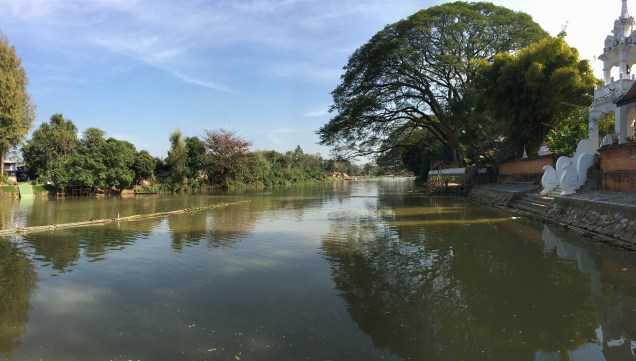
The descent down to the village of Junbesi was an endless slog down a deep valley. The start of our descent passed through a mossy, magical forest of pine and rhododendron. Farther down as we approached the Junbesi river, I was surprised to see road-building activity once again. This road came up the river from the south. Our trek is essentially a eastward march directly across the topographic grain defined by the southward flowing rivers draining the high Himalayas. Hence our route is 90 degrees to the topography and therefore intensely up and down. However, in the aftermath of the 2015 earthquake, the road-building frenzy utilized the north-south valleys to access these rural areas hardest-hit by the earthquake.

1843954D-F921-463D-BDBC-EE69200FECFA
It was a long slog down from the pass, but through some nice forest. Gokul, my porter, is for scale.

As we approached Junbesi from above, we could see the new road, passable but still under construction. Junbesi also had power from a generator downstream. The town is much more prosperous than the small villages along the ridge lines. Our accommodation for the evening, the Ang Chokpa lodge, was a very pleasant surprise. I got a large room with an attached bath AND hot water in the shower. I was even able to access a reasonable town-wide WiFi for about $5, although it went down before I could post this. I’m writing this sitting around the wood burning stove in the toasty common room while digesting my spaghetti dinner (a nice change from dal bhat). Tomorrow looks like a relatively easy flat day on the map, but I have learned that Nepali flat means up down up down up down….


Up and Down Up and Down

There is literally no place flat in the Himalayas, and today’s march from the jJiri to Bhandar proved the point. I climbed over two passes, through three villages, crossed one large river, and passed countless homes destroyed by the 2015 earthquake. My guide said it would take 6 hours, now I know to add 25% to his estimate as the old man factor. We left at 7:30 am, and arrived at Bhandar at 4:30. That included a 45 minute lunch stop at a small, dark lodge perched next to the trail.

Our lunch stop for the day.

The hike passed through pleasant pine forests, interspersed with small family plots growing wheat, rice and potatoes. All of the plots we terraced on the steep slopes. Most of the plots were only a 2-3 meters wide, with a drop of a meter or more down to the next terrace. My mind boggled at the though of how much labor this took, not to mention the DIY irrigation engineering.

6544B291-8745-4739-8334-CF938362EC40
Shivalaya.  The climb out of this village was brutally steep.

This region felt the brunt of the 2015 earthquake. Many (most) of the homes are made of stone and became piles of rubble. Now construction is rampant. In the aftermath of the earthquake, the government, inundated with foreign aid, went on a road building spree. Only a few years ago, getting to Bhandar involved exactly what I did today. Now two new roads service this town. These are only roads in the sense that one can navigate them by truck or 4×4.  They have been scraped into the hillsides, switch-backing up and over passes and down steep drops. My foot trail crossed one of these roads multiple times on the way up and over the day’s second pass. Ankle-deep dust on these roads meant I wore a silky tan coat by the time I arrived at Bhandar.

Many of the lodges have not yet been repaired in Bhandar, the one Is am staying in, Shoba Lodge, was built recently – out of wood instead of stone. I had a nice proud moment when I arrived at the lodge when the other trekkers staying here said they took 2 days to get here to my 1. I did a few imaginary fist pumps. Fortunately, the lodge had a gas hot water heater hooked up to a shower head, so I got the dust off me. Now I’m awaiting for my ration of dal bhat to arrive. I’m thinking I will sleep well tonight.

Highway of Death

I feel lucky to be alive tonight. I have survived the most dangerous part of my trek, the 200 km drive to Jiri. But let’s start at the beginning…

My guide, Bahkta and my porter, Gokul (who is a slightly darker version of the Marlboro man), met me at my hotel at 8:00. We also had a driver who I am pretty sure is in training for the Indianapolis 500.

img_0107
From the left, me, Mario Andretti, the Marlboro man, and Bhakti

Our car was a small Toyota sedan, and we all clambered in and headed out into Kathmandu’s traffic. I asked to sit shotgun, and man, was that a good choice! Bahkta and Gokul stuffed themselves in the back. The first hour was spent getting out of Kathmandu. On the outskirts of town we passed mile after mile of brick factories; the Nepalese were busily creating the tools for their own demise during the next big earthquake. The traffic was stop and go, mostly stop. Finally we emerged onto the the Aranko Highway, a route built by the Chinese in the 1960s that connects Kathmandu to the Tibetan border. After a couple of hours we branched off onto the B.P. highway, a new road built by the Japanese that connect Kathmandu to the southern lowlands.

Let me describe these roads: hair raising (if I had any), vomit inducing, ass-puckering and pee loosening doesn’t begin to do this route justice. Nominally 2 lanes, in reality it would be a generous bike lane in the US. Often, when a truck and a bus pass, both vehicles would slow to a crawl, and inch past each other with mm to spare, horns a-honking the entire time. The road climbed and fell, often with shear drop-offs. Guardrails? Who needs ’em! My driver drove like he was late for his wedding (more likely his funeral). With incredible skill he passed all manner of slower vehicles with inches to spare between us and oblivion. And all this describes the first half of our route.

About halfway, we made a quick stop for lunch – delicious dal bhat and curry.

E750B8E5-27E4-4F6E-8759-6EF718067947
A delicious lunch, Dal baht, the 24 hour fuel

Fear makes the best spice. After lunch, the route crossed a bridge and followed the Tampa Koshi River to the north. The road was now an ancient, nominally paved, single lane trail, pot-holed and washed out by floods over long sections. The road demanded 20-30 km per hour, my driver insisted on 50+ km per hour. Any on coming traffic was negotiated via a game of chicken; we won more than lost. The road then left the river and climbed, and climbed and climbed. Finally, we reached Jiri at 3:30 pm, for a 7 hour 30 minute time – probably my driver broke his own world-record. Jiri turns out to be a rather dismal village at the end of the road. Main Street is a wide but rough dirt road. We checked into a small Sherpa guest house. I bought my crew a beer, and we had another meal of dal bhat. I feeling at once excited and apprehensive about the coming trek. Tomorrow it begins.

Kathmandu

When I last visited in 1986, Kathmandu had a population of 400,000, today this exploding city is now an order of magnitude larger with over 4 million inhabitants. Today I toured some of the famous landmarks of the city with a driver and guide. Dubar square, a couple of famous temples, and a cremation site along the river.

4C5B74D2-8E96-4DD6-B8A5-BBD37107A2BE.jpeg
View of Kathmandu from Swayambhunath Temple

None of this impressed me much, but what did was the incredibly lasting impact from the earthquake that struck Nepal nearly 3 years ago. Over 9,000 people perished in that temblor, but it could have been far, far worse. The earthquake struck at noon on a Saturday which is Nepal’s Sunday. Schools were closed, children were out playing in the streets and parks, and businesses were shuttered. But the property lose was unbelievable. My driver said that in his village only a single house was left standing and that house became a field trip stop for building engineers. Bricks are everywhere. Piles of recycled brick, neat stack of new bricks, and many piles of broken bricks that no one has yet bothered to haul away. Construction is everywhere, yet still has so so far to go. Dust. Oh the dust. A perpetual yellow haze hangs over the city and coats everything left outside. In spite of all this, the tourist district is bustling again; Nepal is open for business.

Scenes from a shaken city

The drive today also reminded me how aching poor Nepalis are. The homeless are everywhere and by comparison the cardboard shacks inhabited by SoCal’s homeless seem like palaces. My tour guide said that over the last 10-20 years, there has been a mass migration from rural Nepal to the city where hopes for a brighter future collided with the harsh reality. Yet in the face of hardship, the Nepalis remain upbeat. My tour guide talked proudly of how Nepal is now a democracy after years of incompetent governance in a country run by kings.

I spent the late afternoon completing my supply shopping, and having a last beer and pizza in relative civilization. Tomorrow morning I will be drive about 185 km (8 hours!) on the Araniko Highway, arguably the most dangerous section of road in the world. I checked it out on Google maps and all I can say is that I hope I can ride shotgun.

The Adventure Begins: Bangkok to Kathmandu

After 32 years, I have finally returned to Kathmandu. I left Bangkok about 11 am after stuffing myself with 3 Krispy Kreme donuts and a cup of Starbucks (my waistline hopes they never open a KK franchise in Chiang Mai, the rest of me does). My flight was delayed by about an hour as we entered a holding pattern south of the city, then waited another 30 minutes on a taxiway while waiting for a parking spot. Although my memory has faded, it seems that not much has changed at Tribhuvan International Airport, it is still tiny and rather chaotically ad hoc. The trekking company I booked with had a driver dutifully awaiting my late arrival, and we drove slowly through the dusty, dusty streets, lined by piles of debris and bricks seemingly still leftover from the Earthquake 3 years ago. I arrived at the small botiqueish Dom Himalaya hotel in about 30 minutes. I was warned to tell the front desk 5 minutes before I showered so that the could turn on the hot water. Yes, I’m back in the third world.

With the remainder of the day free, my first step was to find an ATM. Here’s where my adventure began. My transaction went normally until the screen said “take your cash”, then it flashed “transaction cancelled”. My card reappeared, but before I could grab it, the machine slurped it right back inside. Then the screen reset to “please insert your card”. I could almost see that damn machine smile at me for offering such a tasty morsel. To make matters worse, I got an email from my bank in the US notifying me that I had just withdrawn 35,000 rupees or about $340. So now I am standing there with no rupees, no ATM card, and the bank had just closed 15 minutes prior. I was forced to dip into my emergency dollar cash reserve, which I was able to change into rupees at a nearby money changer. I guess I’ll be waiting at the bank door at 10 am tomorrow morning.

I spent the rest of the afternoon and evening getting a local SIM card, and picking up some odds and ends for my trek. Kathmandu is very different than I remember it. Back in 1986, the streets of the city had more sacred cows than cars. Now the cows have apparently been banished to be replaced by a cacophony of sacred cars and motorcycles. One nice thing though, the main part of the Thames area is a maze of walking streets, no cars. That made for a very pleasant shopping stroll amongst the myriad of small shops selling trekking gear. I finished the evening with a fine meal of Indian food at the Third Eye Restaurant.

A romantic candlelight dinner for one in Kathmandu.

The Great Cultural Divide

There is no better way to experience the chasm that exists between Thai and American culture than to witness some of the rituals surrounding a visit to a Thai temple.  Recently, I visited Wat Chai Mongkhon with my SO on the occasion of her birthday.  Wat Chai Mongkhon lies on the banks of Chiang Mai’s main river, the Mae Ping.  To my pagan eyes, it seems like a fairly ordinary temple, although its riverside setting is lovely.  That same setting, though does allow for a peculiar ritual that I observed there for the first time.

ping river
The Mae Ping River from Wat Chai Mongkhon

On this propitious day, our first stop was a small shop tucked back in a corner of the temple grounds that sells all manner of live fish ranging from guppy-sized up to small-trout-sized.  The same shop also sells various birds in tiny wooden cages – most of these seemed to be some kind of dove.  They also sold live snails, by the bucketful.  This was no pet store though.  The express purpose of this shop is to sell the animals to merit makers, who then make merit by releasing them.  Hmmmm, more on this in a minute….

From the shop we proceeded directly to the temple’s interior where a quick prayer was said accompanied by a few bows and wais to buddha.  This part of the ritual I am quite familiar with and lasted only a few minutes.  From the temple we proceeded to the river bank, where amidst a few more bows and the recitation of a long prayer read from one of the laminated sheets picked from a basket on the pier, both the snails and fish were released.  Their release was followed by a nearly instant eruption from the river – a vicious feeding frenzy of huge carp-like river fish.  As far as I could tell, the newly freed snails and small fish experienced a few nanoseconds of freedom before becoming dinner to these exceedingly well-fed riverine scavengers.

Ok.  To the American mind, this seems very strange indeed.  So let me get this straight, someone goes out and catches some wild critters, keeps them in tanks, buckets and cages, and then someone else comes along, buys these unfortunate critters, and makes merit by releasing them to the freedom of the river, only for them to become instant dinner to some lucky fish.  One would guess that the freed birds might have a better chance to enjoy their freedom – at least you could enjoy watching them fly away to meet their fate, but alas, their cost is quite a bit more.  The American mind cannot help wondering if the merit made by the purchaser sufficiently cancels the merit lost by the animals’ capturers, keepers and sellers.

Now. Here is how the Thai mind sees it……

Sorry, but I have no clue how the Thai mind thinks about this ritual, in spite of numerous conversations with Thais about this very subject. I do know that each kind of fish/bird/invertebrate has a particular kind of merit that is gained by their release.  Some impart good health, others will bring good luck with finances, still others will impart a long life.  You get the idea.

When I asked who decides which animal imparts which kind of merit, my SO replied that that is like asking who decided the meaning of a word.  Wow, that was a very revealing answer! Apparently this ritual goes far back into antiquity, and involves deep beliefs that have been passed down through so many generations that their origins have been lost.  These beliefs run gut-deep and no manner of western logic will unseat them.  My guess is that if you brought a Thai into the Catholic Church of my youth, they would be equally mystified.

The third and last stop in our merit-making was a ritual that I have experienced on numerous occasions – one of my favorites.  The merit-maker grabs an open-ended cylinder containing about 30-40 joss sticks with each stick bearing a number.  While kneeling in front of a particularly plump and happy buddha, the merit maker gently shakes the container until a single stick falls out.  The number on the stick is then matched to a set of fortunes posted on a nearby bulletin board.  Here’s the fortune we got:fortune

I don’t think you can do much better than that!  All in all it was a very educational visit to the Wat Chai Mongkhon.  Please if any of my Thai friends read this, please leave a comment with your explanation of this interesting and (to a western mind) contradictory ritual.

December 6, 2017 – Cycling Tour of Northern Thailand – A Final Look Back by the Numbers

IMG_4247
Doi Pha Klong National Park east of Phrae

I have been back home now for nearly two weeks.  With a bit of perspective, I would like to take one last look back at my cycling adventure “by the numbers”:

1,079 – Give or take a few this is how many kilometers I road on my tour.  Add another 25 km to that to account for a day trip I took to the White Temple in Chiang Rai.  That works out to an average of 98.1 km per day.

11 – Days of riding.  That is not counting the short day ride I took in Chiang Rai.  An additional 2 days were spent on a golf course in Chiang Rai, and one true rest (and laundry) day in Nan.

10 – Number of mountain ranges crossed.  On two separate days, from Chiang Muan to Nan, and Phrae to Lampang, I had to cross 2 ranges.  For 3 days, from Chiang Rai to Chiang Khong to Thoen to Phayao, I rode on the mostly flat terrain of the basins.

2 – the number of times I had to get off my bike and push it up a steep section of road.  Both of these were on the same day, between Phrao and Fang.

1 – the number of other touring cyclists I saw during my trip – it was a European woman I saw in Chiang Rai with a bike so laden that I am pretty sure she was riding back to Europe.  I don’t count the locals pedaling their cruisers around the many small villages and farms – these were too many to count.

2 – The number of times I crashed my bike.  I already wrote about the first time here.  The second time was even more embarrassing than the first, but two weeks on and I can now write about it without blushing too much.  I was coasting to a traffic light on the outskirts of Lamphun on my very last day of the trip.  I was looking at google maps on my iPhone which was mounted on my handlebars trying to find a pleasant route through the Chiang Mai basin.  I was not looking at the road.  I ran smack into the rear end of an empty trailer being pulled by a motor scooter being driven by a grimy construction worker.  Fortunately I was going slow enough that I didn’t fall over.  Smashed up one finger bloody good (literally), with only a small scratch on a break lever, and no damage to the very sturdy trailer.  A huge gash to my ego.  The only person more startled than I was the driver of the scooter his look needed no translator, it cried out W.T.F.!!!, are you $#@&^ing blind?!!! I tried laugh it off which was difficult with blood dripping down my arm.  I finally got to pull out my carefully equipped first aid kit, and I was back on the road again in 10 minutes.  I put my phone away for the duration.

398 – Number of dead snakes seen on the road.   Ok, I didn’t really count them, but there were a lot, as I discussed here.

1 – The number of live snakes I saw.  A 4-5 footer curled up on the shoulder.  I just missed running over it at 25 km/hour.  By the time I realized that it was a snake I was far enough down the road that I didn’t bother to go back and take a picture.  Now I wished I had….

0 – This is the most amazing number.  This is the number of flat tires I had.  I reckon this is because I was so well prepared with patch kits, tire irons, and spare tubes.  I never even put air in the tires.  This must be a testament to the quality of the tires that come stock on my bike, the Marin Gestalt 2.

-1 – My weight change from the day before leaving to the day after returning.  Thats right, negative 1.  I actually gained one pound.  I would like to think it is because muscle weighs more than fat, but I now the truth: No day’s ride, no matter how long or over how many hills, can make up for the prodigious amount of food I ate and beer I drank while on this trip.  I am talking 3 Thai food dishes with a plate of rice washed down with a large Singha beer, and chased by 2-3 Kit Kat and Snickers candy bars.  That is just an example of one of my 3-4 daily meals.  It was sure fun while it lasted; now I am struggling to eat only 20% of that amount and can still feel my paunch growing.

My cycling tour already seems like ancient history.  I am back in my usual routine of pleasant retirement.  But the itch is still there, this week I booked my next adventure, a 21 day trek to the base of Mount Everest.  Stay tuned!


November 28, 2017 – Cycling Tour of Northern Thailand, Epilogue and final Thoughts

I have now been back home 5 days already, and it seems like forever.  It seems like I never left.  While I was on the ride, it seemed like the never-ending-tour.  It seemed like I had been riding my whole life, and still had a long way to go.  While on the tour, life became very simple.  Eat, ride, eat, drink, check-in hotel, write, eat, ride, etc. etc.  I had no appointments to keep, no problems to solve, no one to worry about but myself, and no deadlines other than the setting sun.  On my return, I awoke to dead batteries in my car and iPhone, and spent the day replacing both.  I now have appointments to keep, golf tee times to wake up for (I know, I have a tough life), and the everyday nuisances of normal life.  A part of me misses the simplicity of the road (but not the sweat).

IMG_4229
A misty early morning near Fang – one of the many memorably scenes along my route.

Would I do this trip again.  The short answer is no, but I would do a trip similar to this in a new place.  Would I recommend this trip to others.  Yes, if they were prepared to cycle in the relative heat, adapt to the culture of the Thai roads, and wanted a prolonged experience of Thai culture.  Here are some final thoughts that I hope will be of use to anyone considering a trip like this one:

  1. I chose the perfect time of year to go.  November is relatively cool (nothing over 90 F), with relatively low humidity.  I had one 60 minute rainstorm, the rest of the trip was dry with mostly sunny skies.  Winds are light enough to me a non-issue.  Hotels were empty as were many of the roads.  Any other time of year would have meant dealing with higher or lower temperatures, abundant rain, and/or intense heat.  The forests were still green from the rain season, and it was harvest time for the rice, but they had not yet started to burn the fields (which will turn the air foul by February or March).  This tour is certainly doable any time of year November is nearly ideal.
  2. I had the perfect bike for this ride.  The Marin Gestalt 2 is moderately priced, relatively rugged (without being heavy), and easy to fix and maintain.  I am sure better bikes are out there, but probably not for the price.  I added a rack, kick-stand (an absolute necessity!), and fenders which helped keep me and the bike clean.  I do admit though, that an even lower “grandpa gear” would have been nice.
  3. I travelled light.  No rain gear – I figured I would be wet from sweat anyway, and in November, if it is cold, it will usually be sunny.  I carried only a couple of changes of clothing, and was able to do laundry along the way (although this will usually mean  a rest day because clothes must be line-dried).  I carried only a small cache of emergency snacks – food was easy to find almost everywhere.  I stayed in hotels, so no camping gear was needed.  Bottled water is everywhere and cheap.
  4. If I could re-plan this trip, I would avoid the heavily travelled road between Lampang and Chiang Mai, and perhaps take a quieter route from Phrae to Lampang, or skipped that area altogether.  The rest of the route was on lovely quiet roads with only short sections (near towns) of heavy traffic.  I would have like more time spent cycling along the Mekong – this was the most memorable part of the trip.
  5. I had a Cat’s Eye wireless odometer that I can only give a mixed review.  It on occasion just quit working – most likely because the sensor – pick-up gap was too large.  Unfortunately the design of the Gestalt’s front forks made adjusting this gap difficult to impossible.  The real winner was the iPhone mount teamed with the Cyclometer Elite app for OSX.   It gave me all the stats I needed with a very easily read display.  The only downside was the large battery drain on my iPhone, but the back-up battery in my iPhone case more than compensated.

This and my soon-to-come “by the numbers” post will be my last post specifically about this tour.  If anyone is thinking about a ride like this, I am happy to answer your questions.  Reach me at bprhodes@mac.com. I do not no where this Blog will go from here.  I am sure I will find something to say.  Stay tuned!

November 19, 2017 – Northern Thailand Cycling Tour – Summit Day!

img_4227
Graph shows distance versus elevation. Ugh!

Wow, that was a lot harder than I thought! My plan for the day called for a ride of just 68 km, by far my shortest ride of the entire tour. What I did not realize at the planning stage, was that this route climbed over two mountain ridges and numerous other smaller ups and downs, resulting in a total of 998 vertical meters – doubling the climb of my next hardest day.  The result is that today actually felt like my toughest day, rather than what I though would be my easiest day.  Even though I got an early start of 7:45, I still arrived in late afternoon.  But I made it!  By reaching Nan, I have reached the ultimate goal of this tour.  For me, Nan has always had the aura of an isolated and remote province.  I initially though I would drive here.  But when knee surgery last year forced my to quit running, I bought a bike, started cycling around Chiang Mai, then decided to cycle to Nan.  My plans became increasing ambitious, resulting in this tour.  I feel like the mountaineer who has reached a long sought summit: bone-tired, a little let down, and apprehensive about the decent – in my case the ride from here back to Chiang Mai.  More on that below.

The ride out of the very quiet Chiang Muan valley began almost immediately, climbing to the first ridge in just over 12 kilometers. Just after reaching the crest of the ridge the road plummeted down to the The Baan Luang Valley.  There I paused for a late morning cup of coffee, and stocked up on my water supply.

Then up I went again, this time very steeply, over a ridge covered in lush jungle.  When I finally reached the ridge crest, it was mid-afternoon already, and quite hot.  The way down to Nan from there was a series of roller-coaster hills where You go up 10 meters for every 15 You lose.  To make matters a little more interesting, one of the steepest downhill sections was being reconstructed and I had to inch down through the mud made by a dust mitigating water truck.  The mud caked between my tires and fenders bringing my rear wheel to a wheezing stop.  Another 30 minutes was spend scrapping out the gooey mud so that my tire would spin again.

I finally arrived in Nan about 3:30 pm, some 3 hours later than expected.  After checking in to the Baan Nan Hotel, I brought my bike to the Nan Cycling shop, and left it for them to clean up, and adjust the gears.  They did a great job for only 250 baht.

I don’t have much to say about Nan.  The idea of the place far surpassed the reality.  Nui, the proprietor of Nan Cycling, was hard pressed to think of anything to see in Nan besides one museum and some temples.  Perhaps interesting sites lie outside of  town, but those will have to wait until I come back in a car.

Every mountaineer, when he or she reaches the summit of a remote, difficult and/or strenuous peak, knows well that the descent will be even more strenuous and difficult than the ascent, and potentially more hazardous.  I am apprehensive about the final 3-day ride back home, my “descent”.  Each day of the three is over 100 km in length and involves crossing at least one mountain range.  I will spend tomorrow – well actually today as I write this – eating, getting laundry done, resting, eating and hydrating.  Hopefully, I will be able to escape my “summit” very early Tuesday morning, bound for Phrae.

November 18, 2017 – Cycling Tour of Northern Thailand – Small Town Thailand – Phayao to Chiang Muan

Chiang Muan doesn’t even have a traffic light. Lying half way between Phayao and Nan, tucked neatly in a basin surrounded by mountains, this small district within the Phayao Province has a population of just over 19,000 widely scattered over 723 square kilometers. The entire district consists of 3 small villages, with most of the population living in the surrounding rural areas.

8B5D61E6-FA21-4318-94B2-07DB02003845
Downtown Chiang Muan at sunset on a Saturday night.

I am staying in the largest of these villages which fortunately sports two small hotels.  My first choice had a for sale sign hung on the office door, and no one was around.  My second choice did not have a for sale sign, but also was deserted.  Fortunately, the phone number on the sign worked and rustled up a gap-toothed local guy in a beat up pickup truck.  He took my money and gave me a key, no passport, no sign in, no credit card.  I love these small villages!  The hotel (not sure it qualifies as a hotel with only 4 rooms) was actually very nice with a decent sized, clean room with a/c, hot water, twin beds, and a small refrigerator all for the princely sum of 500 baht (just over $15).

5293BC79-6FF5-4EDF-BEC9-C7FA6DDA1BB5
A deserted road – just how I like it.

Todays ride took me over one of the many branches of the Phi Pan Nam Mountains. Here the range is not particularly high, my high point for the day topped out at just under 700 m.  All but the steepest slopes were covered with corn fields turned to the their post-harvest brown.  The ride over the mountains was very peaceful, no traffic, no villages, and only the occasional farmer tending their fields and waving at the crazy man huffing and puffing up the hills.

Tomorrow I will reach the “summit” of my trip.  I have always looked at Nan as being my ultimate destination.  A shortish ride over another range of hills should get me there by early afternoon.  Talk to you from there.