The Final Chapter

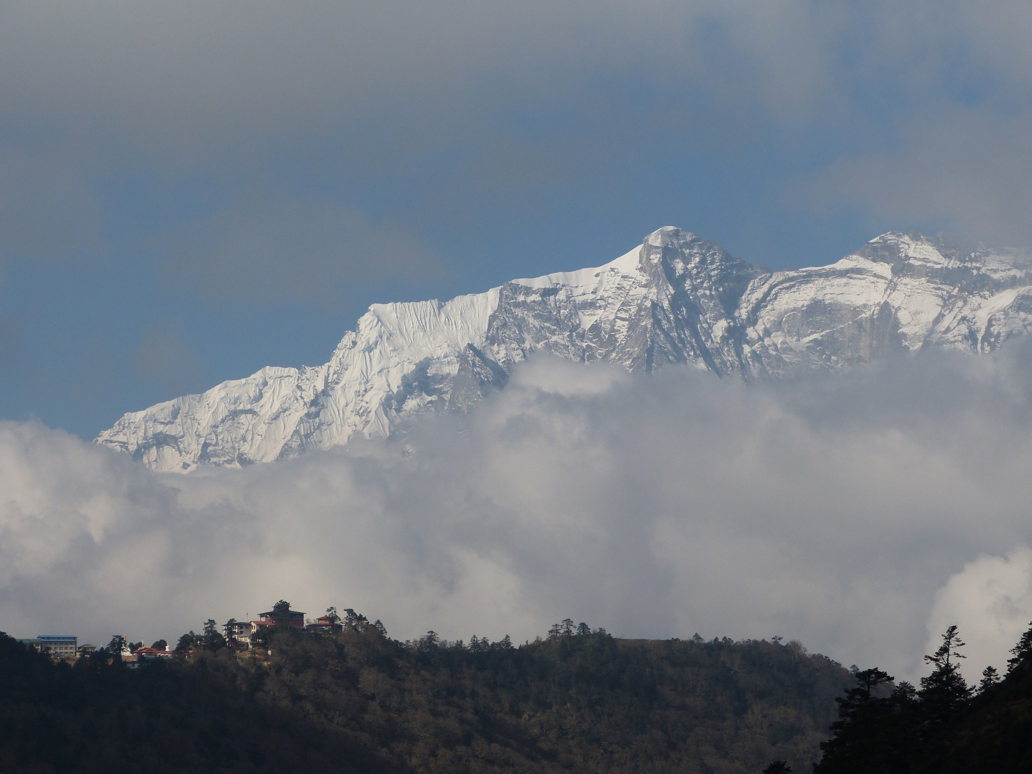
I woke up on Friday April 5 in my tiny twin-cotted room with a large pomelo attached to my knee. When I moved to get out of my sleeping bag, that pomelo screamed “don’t move me!” Apparently that sharp pain I felt during yesterday’s descent was not trivial. It really is a good thing I didn’t have to hike anymore. The day dawned bright blue and green. I was ready to go by 6 am. I spotted my pilot once again talking earnestly on a borrowed cell phone – his had run out of battery.

It amazes me how ill prepared my pilot appear to be given that he was flying in the worlds highest mountain range, with questionable weather that might cause him to land and even spend a night in almost any environment imaginable. Really, there aren’t regulations about this? He literally had only the clothes on his back. I ask him about this and he said he never brings anything. No suitcase, no cell phone charger, no clothing other than his leather flight jacket, no toothbrush , no nothing. Really?! I noticed the other pilots had small backpacks with them, so maybe he is an exception.

I limped out to the helicopter and asked him when we would go. Not so fast, the bad luck was still with us. Now that it was clear in the mountains, Kathmandu was closed by smog/smoke/haze causing low visibility. One by one the other choppers lifted of to fly to Lukla – their original destination. Only the two of us were left to await the weather in the Kathmandu Valley.

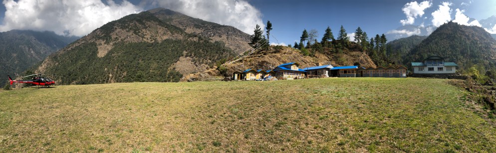
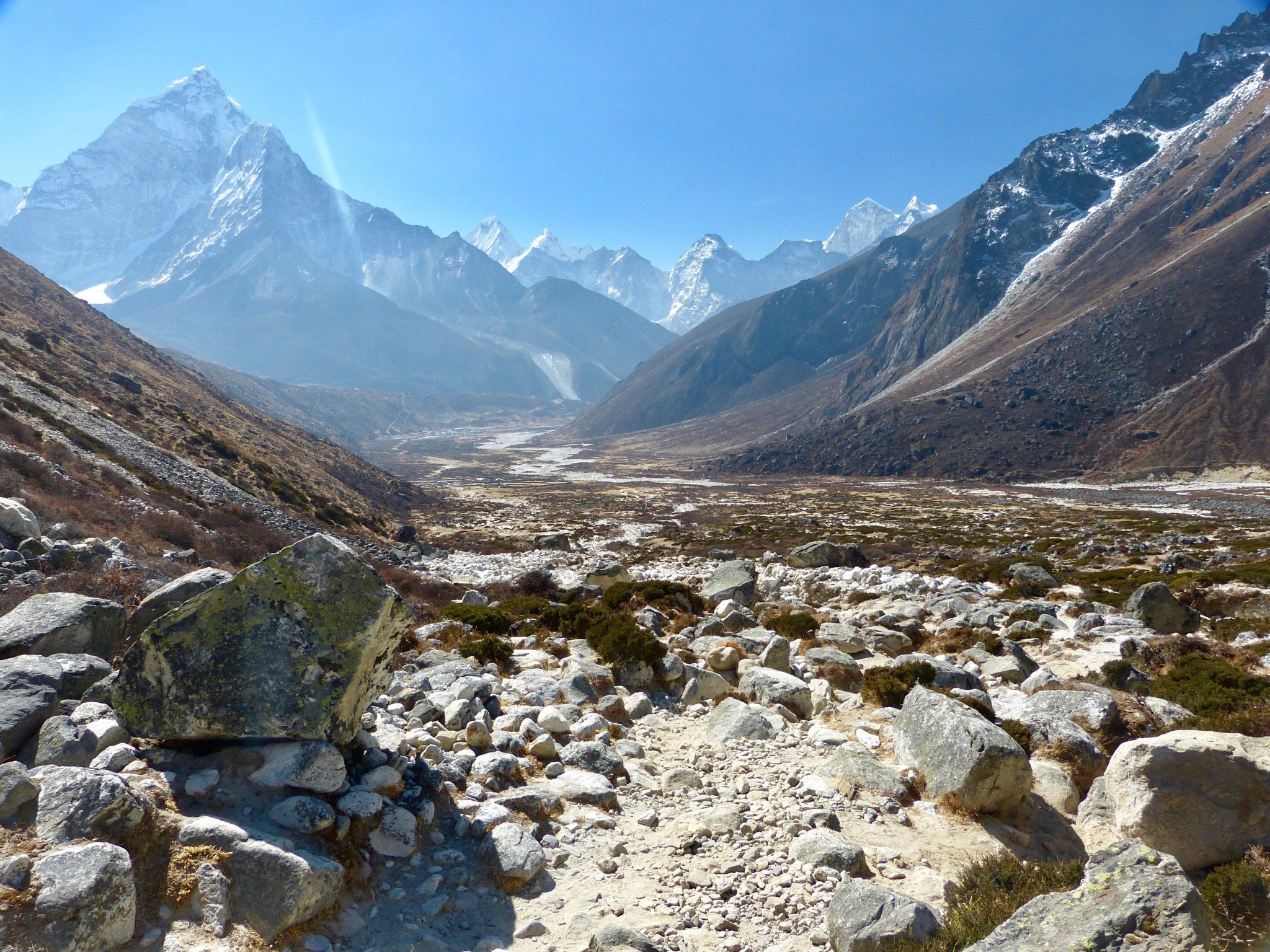
I hobbled around the landing pad, really just a small terrace that lay above the valley floor near the confluence of two drainages. It was perfectly suited as a helipad, with sufficient space around it to allow for take offs and landings. It looked pretty full with 4 choppers parked there, but the owner said he could squeeze in 12! His record was just 10 though. He charged landing fees from the airlines and also earned on food and lodging from their pilots and passengers, He prayed for fog I guess.

About 11:30 am, with the clouds starting to build around the peaks, my pilot final said let’s go! Kathmandu was just at the weather minimum and he said we would divert to another lowland airport if we couldn’t make it into Kathmandu. Earlier that morning, the pilot told me that he had house guests staying with him in Kathmandu, so he needed to get back home. Nothing like having a super motivated ill-prepared pilot flying you down to safety! The previous day I googled “Dynasty Air” to look up their safety record. Big Mistake.

We were soon in the air twisting and turning down the valleys to avoid the higher ridges. Once near the Kathmandu Valley we were forced to hug the ground to avoid the smoggy clouds. Visibility appeared to be just at the 1000 m minimum. We landed next to several other choppers at the communal heliport at Kathmandu Airport and I resisted the urge to hop out and kiss the ground.

I was met by an ambulance that whisked me off to Swacon Hospital. As it turns out, anyone who is rescued by helicopter must be evaluated and spend one night in a hospital if they want their insurance to pay. This makes some kind of sense, otherwise any tired trekker could just pant a little and request rescuing, and the insurance would cover the cost of their laziness. However the system is also rigged to pay maximum benefits to the hospital. I was given a physical exam, blood tests, X-Rays (ostensibly to screen for pulmonary edema) and made to stay overnight, my hospital room for the night was really just a cramped hotel room, complete with a set of toiletries in the private bathroom, and room service (food wasn’t bad). The only sign that it was a hospital room was a bare IV rack shoved into the corner.

The rest of my story is anticlimactic. I was released the following afternoon after I spent all the day fulfilling the insurance companies paperwork needs. I was picked up by one of the Nepal Hiking Team’s drivers, and deposited back at the Dom Himalaya Hotel. The next day was spent dealing with flight changes and more insurance hassles. After two nights at the hotel, I endured the uneventful flight back to my home in a Chiang Mai.

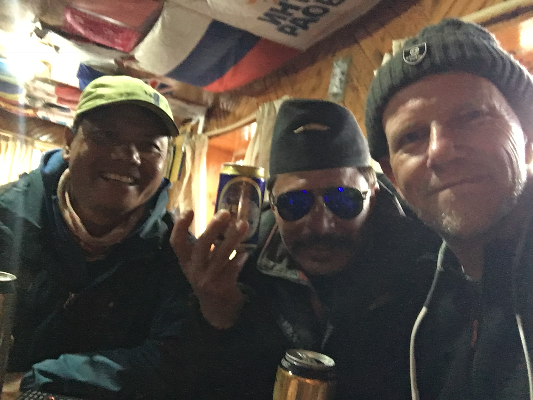
The great news is that my erstwhile partner, Tom Prouty, successfully reached Everest Basecamp and safely returned to Lukla using his own two feet. I have to admit a little chagrin that the older, cigarette-puffing, beer swilling dude was able to do what I could not.

Epilogue

Ironically, I am now lying in a hospital bed in Chiang Mai. The morning after I arrived back home, I was stricken with severe stomach pains. I endured the pain until evening, then drove myself to the hospital. It turns out my kidney stones were on the move and the likely cause of the pain, but a CT scan used to verify that also showed a dreaded “soft tissue mass” clinging to a hard-to-reach part of my small intestine. I see biopsies and potential surgery in my future. This incomplete story must await a future blog, but perhaps I am really lucky to have not been stricken while high in the mountains. Hard to feel lucky now, though.

Surke Helipad and Lodge

My Demons Return Part 3

Sitting around in the lodge, opposite the Lukla airport, watching the thick fog roll in, I mentally prepared myself for an overnight stay here.  Lukla is not a bad place to hang out.  It is fairly low, so after the thin air, I could actually breathe pretty well here.   The food is pretty good because many of the ingredients are flown in fresh.  Its pretty clean here too, with a nice “main street” paved with schist and lined with shops and even a few bars.  Not a bad place to get stranded.

As I was sitting reading the news on my phone and enjoying the fast 4g internet here, I noticed my porter, who speaks only a few words of English, in a conversation with the lodge owner (ok that is an assumption, be he seamed like he was the boss).  Suddenly, the boss-man walked over and said “you walk down to Surke.”  Huh? What? Where? “They have helipad there, no fog.”  Oh!  “How far is it?”  I asked.  “Walk one hour” was the reply.  Well, that didn’t sound too bad.  Then I remembered that the Nepali sense of time for walking involved using worm holes and warp drives.  “Now?”  I asked.  “Yes!  Go!” was the reply.

My poor porter, who thought he was already done with me, looked chagrined.  We walked back down to the helipad where my duffle bag was waiting in hopes of the fog clearing. There stood my pilot next to his impotent helicopter looking a bit agitated, talking on his phone and still in his flight jacket and street shoes.  He clicked off the phone, said a few words to my porter, then looked at me and said “Lets go!  I go to Surke with you.”  Off he went down the paved rock stairs that paralleled the steeply-sloping runway.  “Follow me!” he called over his shoulder.  I looked at my porter; he was already rigging the tump line to my duffle bag.

Down we plunged into the mist.  Most of the trail was nicely paved with stone stairs.  Steep stairs.  Some of the stairs involved a 3 ft drop, maybe more.  We plunged down, only leveling off to bypass stone dwellings or to cross the steep ravine on steel bridges.  Down, down, down.  I had to hurry to keep up with this pilot dude walking in street shoes and his flight jacket (no bag of any kind).  To add to the sense of adventure, the pilot stopped at almost every house and asked for directions.  It was quite obvious he had never been down this path, nor had my porter. After walking about 20 minutes, the pilot called over his shoulder “only 30 minutes more!”.  Not.

Somewhere around the 50 minute mark, I stepped down a high stone riser and felt a stabbing pain in my right knee.  That’s the surgically repaired knee that had been sore since our acclimatization hike at Namche several days before.  Suddenly feeling quite unstable, I slowed down, but kept going.  What choice did I have?  My pilot cum guide disappeared down into the mist.  I used my trekking poles like crutches, hopping down the steep path on my good left leg.  After another half hour of hobbling, we found ourself at a dead end in some terraces where the trail petered out.  My guide started calling out to the small dwellings for someone to guide us onto the right path.  Finally we found a local working in his garden who pointed down the hill.  Down we went for another 15 minutes, when we finally rounded a corner to see 4 helicopters parked in the mist in front of the “Surke Helipad Lodge”.  We had descended 550 m vertically in just 1.6 km (nearly 2000 ft in a mile).  Perhaps one of the steepest paths I’ve ever seen.

The swirling fog that shrouded the helicopters made it clear that we had wasted our time, energy, and, in my case, meniscus, on this long plunge down into the gloom.  If anything, the fog was thicker here.  Then it started raining.

We sheltered in the lodge’s small dining room.  Three other American’s were huddled in the room looking exhausted,  along with 3 other pilots. The Americans comprised a young Mormon couple  (the husband was suffering from Nepal-belly) and a talkative middle-aged guy from I-can’t-remember-where (Texas maybe?).  They had evacuated via helicopter from Gorak Shep, the town just below Base Camp.  They were headed to Lukla to connect with a fixed-wing flight, but got diverted to Surke just before the fog dropped down.  We all waited futilely for a couple of hours, then I threw in the towel and got a room.  I asked the lodge’s owner for the penthouse – he gave me the room closest to the toilet ( a squatter that was impossible to use given my throbbing knee).  It was not a penthouse, but it was dry.

Following a sponge (baby wipe) bath, I shuffled back to the adjacent ding room and joined the 4 pilots, 3 Americans, and the lodge own and his family.  He had a daughter of 25, and was raising his 6-year-old niece whose mother had died just 6 months earlier during childbirth, apparently a common occurrence here where medical assistance can be a day or three walk away.  The pilots were already into there 3rd or 4th beer.  I thought about buying them all a round, then I thought – “hmm, I would rather not have a drunk or hung-over pilot in the morning”.  Didn’t slow them down at all though.  After drinking a beer, and while I waited for the chef (owners wife) to prepare meals for all these unexpected guests, I ordered up a Tongba.

Tongba is the classic alcoholic drink of eastern Nepal.  It is made from fermented millet, which is a hardy cereal grain grown in many developing countries because of its high tolerance for adverse weather conditions such as drought.  Ok, look it up on wikipedia, I had to.  The grain is fermented into a mush by adding various nasty molds, bacteria and yeast, then stored for up to 6 months in sealed jars.  When ready, the mash is added to a special wooden vessel, with an integrated straw.  Hot water is poured over the mush, and after a few minutes, the alcoholic, warm “tea” can be slurped up with the straw, which has a built in filter to prevent you from slurping up the mash.  When empty, you add more hot water to the vessel and you slurp up a second round.  In fact I got four rounds out of it (I think, I wasn’t really in any shape to count after the first two).  The taste reminded me of hot sake.  Not bad, but won’t replace a good IPA.


Tongba

By the time I finished the fourth round, the weather had cleared, and the stars were out.  The pilots and lodge owner (A guide himself who had climbed to the top of Mount Everest twice) had retreated out to the front yard where several stump-chairs surrounded a wood burning stove.  The lodge owner soon brought out a case of Everest Beer and announced that it was on the house.  Somehow, later that night, I stumbled back to my room and collapsed onto my cot.  Supposedly, I was to be up at 6 am for a crack-of-dawn flight down to Kathmandu.  Hopefully.

Next up: The final Chapter.


Drinking with my pilot buddies and hoping that they won’t be as hungover as me.


Cold

This is a short post today because I am COLD. Today we hiked up to Dengboche sitting at 4,400 m (14,436 ft) in a broad windswept valley. We are now in the alpine tundra zone where most of the vegetation is no higher than your knee. The temperature from the start of our hike was well below freezing, judging from all the ice on the trail. The day began clear, but as is par for the course, clouds began building by noon, and an icy wind brought a few swirling snow flakes.

Upon arrival, I was chilled to the bone. I got myself organized, had a cup of hot lemon tee in the dining room, and went up to my cubical of a room and crawled into my sleeping bag with all my warm cloths on and I even threw the woolen blanket on top for good measure. I almost dozed off, but the cold awakened me, I just could not get the chill out. This is a likely side effect of the thin air. I went down to the common room, which is marginally warmer due to body heat, had a hot chocolate and plate of popcorn, and now I feel much better.

Today’s hike was not difficult, but the thin air kicked my butt. Last night I did not sleep well, so I am hoping tonight will be better. I have Ambien waiting, but don’t really want to use it, at least not yet.

Alpine tundra on the way to Dingboche

Windswept Dingboche

On the Khumbu Interstate

Today started under bright blue skies and crisp cool air and finished under gray skies, cold wind and swirling snowflakes. We are now safely ensconced at the Tashi Delek Lodge just 50 m from the famous Tengboche Monastery. I had a chance to go into the monastery today (last year it was closed to visitors when I passed by). The main room with a huge Buddha in the back was the most colorful temple I have ever been in – and I have been in many. The walls were adorned with intricate full-color drawings from floor to ceiling. A lone middle-aged monk sat in the middle of the room, wrapped in dark saffron robes to ward off the 0 C chill, solemnly chanting from an ancient-looking book. Sorry, no pictures were allowed, but it was a magical scene.

Today’s hike was both pleasant and brutal. The first half of the hike was mostly down hill under sunny skies; the second half was a brutal trudge up the hill into the thin air to the high ridge where the monastery guards the entry to he Everest region. We both took it really slow, but still arrived by 3 pm. We are now sitting in the large dining room of the lodge next to a wood-fired stove, sipping various hot drinks. I still feel chilled to the bone, and it’s only going to get colder.

Tom and I were chatting the previous night and he mentioned that the trails here were not what he expected. He expected trails like Americans encounter in our national parks, well graded, switch backed to avoid steep sections, and, except for the most popular, largely devoid of hikers.

The “trails” in Nepal are their roads. They form anastomosing networks of pathways that connect every inhabited village in the rugged terrain that characterizes the vast majority of Nepal’s area. The paths that connect more densely populated areas and/or popular trekking areas, particularly here in Sagamartha National Park, have sections of trail that are dirt paths through pine and fir forests, but many sections are paved in stone.  The steeper sections of trail consist of long stretches of stone stairs, engineered to withstand the hordes of boots and hooves. Everywhere, human and beast pack the trail.

The route to Everest Base Camp is akin to an American Interstate Highway. As I marched along today, it reminded me of the section of interstate 15 that connects the LA megalopolis and Las Vegas. Like that section of highway, a variety of transport plies our trail. The Yaks are the 18 wheelers of the Khumbu, carrying the vital supplies to feed and otherwise support the hordes of trekkers. The porters are Nepal’s pick up trucks. Just like in the USA they come in a variety of forms ranging from overloaded Ford 350s lumbering up the trail (porters can carry up to 100 kg – more than twice their weight), to trekking-company porters analogous to lowered Toyota pick-ups, complete with boom boxes blasting out the latest Nepali hits. Then there are the flat-bellied climbers and guides, the Ferraris of the Khumbu, flying by with crampons and ice axes dangling from their $400 back packs.

While I was a grad student, I took a term off, sold everything I owned, and went to Alaska and climbed Denali. When I returned, I was flat out broke. I bought a 1963 Ford Galaxy off a downtrodden used car lot in Missoula, Montana. It was 17 years old when I bought it for $200 cash. The seats barely kept your ass from scrapping the pavement and it’s muffler was partially intact and partially swinging in the breeze. But it ran…kind of. It blew blue smoke, and steered like a drunken party boat on Lake Mead. Every 100 miles or so I pulled into a service station and filled up the oil and checked the gas. Today, as I slogged up the trail, huffing and puffing in the thin air, I felt like that 1963 Ford, leaking oil and sucking air, amid the late model transport blasting by me. But I got here.

Scenes from the Khumbu Highway

E718C417-BB77-48FB-923B-3E2E2D3DFC85
Blue skies and snowy peaks!
5F1E3CFF-12FF-43F9-AC92-BC280CAA5E6F
Entrance to the Monastery at Tengboche

Why I Couldn’t Breathe

The long walk from Namche Bazar to the airport town of Lukla took all day. While mostly downhill, the trail climbed in many places because of the rugged terrain. I had plenty of time along this tiring march to think about the last two weeks, and why I couldn’t complete the trek.

A55A7264-923A-47EE-8C24-69193535E3F3
My lunch stop on the last day.  Lots of ups and downs going along this valley.

About 15 years ago, one afternoon I went out for a run and found myself gasping for breath after only a few minutes. I fought through it, and my breathing improved and I was able to complete the run. For the next couple of weeks, the same thing happened, it was as if my lungs were closing down at first, but then would improve if I went slow and relaxed. I went to my family doctor and he suspected I had some kind of asthma. He prescribed an inhaler to be used twice a day. It worked like a miracle. I told the doc on my follow up that it was like having 25 year old lungs again. A few years later, after a long bout with bronchitis, my doc referred me to to a specialist, who confirmed my asthma diagnosis. I had feared that I had COPD, but the specialist said that the inhaler wouldn’t work on that, and that his testing indicated asthma. Relieved, I still suspect that this stemmed from growing up in a miasma of second hand smoke from my mother. For the next several years, I used the inhaler only before vigorous exercise and it worked very well for a very long time.

After retirement and my move to Thailand, I found out that I no longer needed the inhaler. Being older, I didn’t exercise so vigorously, and my lungs seemed to like the moist hot air of the tropics. The bag of inhalers I brought from the USA with me got stashed in the back of a drawer and forgotten. A couple of times during my preparations for the trek, I thought to myself that I ought to take an inhaler along “just in case”. But that item never got on my list, and I didn’t remember again until I was in Kathmandu. BIG MISTAKE. My guess is the extremely cold, dry air triggered my asthma. I was ok while hiking if I started slowly, but it seemed to kick in again while trying to sleep. This would explain my lack of headaches or other typical symptoms of altitude sickness. It also explains why my sleeping troubles began at just 2500 m – it wasn’t the altitude alone, it was primarily the cold dry air. If I had brought the inhaler…..anyway, it’s done now. I have no regrets about turning back.

427C433D-0DC5-4BAF-9088-8A6F0E026909
The narrow streets of Lukla.  No motorized vehicles except for planes and helicopters.
64F6E909-A87A-4D52-B6E8-F07C28878270
The picture does not capture the true slope of this runway.

I arrived at Lukla about 4:30 pm after hiking in the light rain for several hours. The lodge was literally 50 meters from the runway. Lukla’s airport is unique in that it is not level. It slopes wildly in fact – more than 11 degrees! It looks more like a ski jump than runway. Planes land uphill and take off downhill no matter the wind. Planes landing have only one chance to get it right because an aborted landing is made impossible by the mountain rising of the end of the runway. Many consider this airport the most dangerous in the world.

I bought a few beers for my guide  Bhakta and my porter Gokul. Gokul had a few more than a few, and was very loose by the end of the night. Apparently he had a reputation as a brawler in his younger days, he could take on 4-5 others with no problem. Good to have him on my side!

201EFC39-F00F-4C82-B19B-E21352B38F68
Bhakta, Gokul and me celebrating the end of the trek in Lukla.

The next morning, after an E-ticket takeoff, and a scenic flight back to Kathmandu that brought home just how high and immense the Himalayas really are, Bhakta and I arrived safely back in Kathmandu (Gokul turned around and went portering back to EBC from Lukla with a new group of trekkers). Thus ends my adventure. I am back in Kathmandu for one night already, and though the flights are full I will try and get back to Thailand tomorrow. I will be writing another post in the next few days on the equipment I brought that might be useful to future trekkers.

D10506C4-C891-4642-A088-58B5914AFA5A
Walking to our specially designed short take off and landing Sita Air plane for the flight back to Kathmandu.

So what next adventure should I start planning for in 2019? 1. Patagonia? 2. Cruise to the Galapagos? 3. Cycle New Zealand. 4. Golfing in Ireland. 5. Drive the Alaska Highway? 6. Something else?  Leave me a comment with your suggestions.

The Worst Night of my Life


Written on March 19 USA time will be posted when internet is available.

Just when you think things are under control, and your goal is in reach, WHAM!

Last night I was feeling pretty good, in spite of the frigid and windy weather. I hung out in the smoky dining room until about 8 pm, then went up to my tiny room. I took two bottles of hot water with me as insurance against the cold. Once under the sleeping bag and warm, I played with my phone for a few minutes then turned it off and tried to sleep. Back came the irregular breathing that has plagued me off and on for the last week or more. Every time I thought I was drifting to sleep I would sit up gasping for air. This was compounded by having to pee every 20-30 minutes, thanks to the diamox. I brought a pee bottle into my room to avoid the long trek down the hall, but even getting up to pee in the bottle left me freezing in the sub zero temperature (close to 0 F). Throughout the ordeal the breathing issues continued.


About 4 am I gave up and turned on my phone and pulled up the NYT crossword in the hopes doing a crossword would calm me down and help me get at least an our or two of sleep. However, I found I couldn’t focus at all, my mind was a swirling miasma, I couldn’t even solve the easiest clues. I gave up and lay there gasping, waiting for the the frozen dawn to come.

Reality really hit me that morning when I returned from a trip down the hall to empty my now full pee bottle. When I arrived back at my room, I couldn’t figure out how to take of my slip on sandals. I stared down at the confusing straps for several moments like they were some escape artist’s invention. Finally, I figured out all I had to do was to just pull the Velcro strap. NOT good.

Dawn finally arrived. I found Bhakta in the dining room, I ordered a breakfast that I could not eat (another pertinent symptom) and we discussed what to do. I basically had two choices: 1. Head downhill. 2. Try staying another night at Lobuche at 5,000 m or 16,500 ft and see if I can shake these symptoms. The most common symptom of altitude sickness is a severe headache, which I curiously did not have. But the breathing issues, insomnia, loss of appetite and mental confusion were. I considered option 2….Another night in this god forsaken frigid lodge, with the disgustingly frozen toilet, living in a 3 m x 3 m cell with a window the size of my iPad was not appealing. What if my symptoms get worse? Then I would be potentially looking at a chopper evacuation. If my condition stayed the same, I might be looking at walking out in an even more exhausted condition than now. In the end, the decision was easy, I would turn my back on Everest Base Camp and self evacuate while I could.

Perhaps surprisingly, I was not really disappointed by missing the chance to visit Everest Base Camp, and only slightly disappointed to miss seeing the view of Everest from Kala Patthar. For me the journey is the goal, not the end of the journey. I didn’t want this one to end in a helicopter. The cause of my illness could be any of a number of things, and I may address that in a future post.

516B0C05-6276-4B6D-BD18-C50D7314F4EA
Periche lies off in the distance at the end of this endless outwash plain.

Down I went, stumbling and bumbling my way down the rocky trail back towards Periche. I moved very slowly, and Bhakta was never more than a step or two away. I’m pretty sure that if I dropped dead, he would catch me before I hit the ground. Finally we reached the part of the trail that dropped down off the moraine, thus losing about 300 m of elevation. We paused at the small lodge at the bottom of the moraine for some hot chocolate, and I ate a half a bag of my homemade gorp. After that I felt considerable better, but still weak, as we marched down the long outwash valley between the moraine and mountains. We stopped for lunch at Periche,  and that further revived me. Our goal was the lodge-village of Pangboche (elevation 3930 m or about 13,000 ft). This would give me more than 3000 m of elevation relief. But the descent from Periche was exhausting. We arrived about 3 pm and I managed about a 30 min nap before dinner without any issues. Hopefully, I can get a good sleep tonight. I will continue my descent to the airport at Lukla in the hopes of catching an earlier flight to Kathmandu. I have no stomach for going back up any time soon.

6EE41BE1-904D-4970-982D-F774273D8F79
In spite of my condition, I couldn’t help admire the view of Ama Dablam.

The Home Stretch!

The post is being written on March 18 USA time.

The day dawned bright and sunny with only light winds, but bitter cold. I felt good enough to move on, but my sleep was not the best.  After my typical breakfast of fried eggs, a couple of pieces of toast (no butter), and some fried potatoes, we headed up the trail at about 8:15 am. Today was a fairly short day; our distance was limited by the placement of the villages, and limiting elevation gain so as to allow acclimatization. I also walk very slowly at this altitude.

The route continued to follow the dwindling Dudh Koshi and initially contoured high on its left slope. We gained elevation gradually, but you could still feel the lack of air in my lungs. Thankfully, my cough has subsided somewhat, but soon the bitter cold air made my throat scream. The land was brown and punctuated by soaring icy peaks. I will let some photos do the talking here:

After our lunch at Tukla, we made a right turn and began a 1 hour climb up a towering moraine of the Khumbu Glacier, the glacier that originates in the cirque between Lhotse and Mount Everest. When we reach the top, we encountered a virtual graveyard. Not actual graves, but memorials to the scores of climbers who have perished trying to climb Mount Everest. I would have liked to spend a couple of hours looking at all of them, but it was damn cold and my lungs were searing. About 40 minutes later we arrived at Lobuche; an early day as we arrived before 2 pm.

6C5019F4-5E07-429F-AF9B-2A1CB7D7BD97
A line of memorial cairns at the entrance to the Khumbu.
157C3561-F017-46BE-BE56-4CA3E66E6902
A colorful memorial facing the Himalayas
0A854AEE-06A1-4770-AD8F-8CBED4043744
A memorial plaque to a lost Russian climber.

The lodge here is not too good. I have a long march down a hallway to the toilet. I solved that problem; I procured an empty plastic bottle, so no trips to the loo. The lodge was packed, there are only a few lodges here, so all the lodges are pretty full. The staff are mostly young Nepali who work here during the trekking season. When the yak poo fire wouldn’t start, these kids made an attempt to get it going with a few pieces of wood and kerosene. They managed to get it going only after filling the room with smoke and the strong odor of kerosene. I fully expect a terrible headache tonight from the fumes, but the alternatives meant being somewhere far too cold. Thankfully, I spend only one night here.

1174EFCC-9FD9-4065-B3CB-7EF2181167D4
Guides and porters gathered around the stinking yak poo fire.

Tomorrow, the plan is to hike to Gorak Shep that last village before base camp. After a snack there, we will continue onto EVEREST BASE CAMP! Lungs and legs willing.

Cold at 4,400 m

No internet here, so although I’m writing this on March 16 USA time, I won’t be posting until a future day.

I had another terrible night of sleep, ruined by frequent trots down the hall to pee – a side-effect of the Diamox I am taking to prevent altitude sickness – and bitter cold seeping into my sleeping bag from below. The dawn was clear, but gathering clouds greeted the start of the day’s hike. To top it off my breakfast of a cheese omelet didn’t have much cheese, and two eggs was just not enough.

FDAE0D10-5C7E-4E91-A5FF-D8F3DA431DD1
Clouds gathered around the peaks, and a cold wind began to blow.
DA2B8AAD-27AC-437B-BF89-0F407B72EA55
We were now up in the alpine tundra, too cold for trees…and humans.

The hike actually was not difficult, except for the altitude, but I had very little energy. The route followed the Dudh Koshi, with two suspension-bridge crossings. I trudged along at a snail pace, and felt a bit better after my lunch of fried potatoes, cheese, and egg. I’ve had very little meat with during the trek, just some buffalo stew lower down.  I’ll be ready for a big old steak when I get home.

After lunch, the sky had become overcast and a cold, cold wind blew.

9289BBF3-C7C4-421E-96F0-3A31E3C2F344
Cold at our morning tea stop at Pangboche 

We were now over 4,000 meters high (about 13,200 ft) and no trees broke the wind. The land had turned brown and tundra-like. Then it started to snow lightly. By the time we reached our destination, Dingboche, the wind was bitter cold and the temperature well below 0 C (probably in the low 20s F), and by nightfall a dusting of snow had accumulated on t he frozen ground.

Fortunately, Dingboche (4400 m high) is a fairly large village catering to trekkers and yaks, so I have a relatively nice lodge, with en suite squater so no cold trots down the hall tonight. In the lodge I met two young Americans, Carter and Justin, who had quit there jobs and were roaming the globe. We had a couple of hours of good conversation around the yak dung fire. Tomorrow is an acclimatization day, so I’ll be here a second night. Tomorrow, Bhakta wants me to hike up the mountain to 5100 m and back, I will only commit to 4450 m. So we I’ll see.

Healthwise, I feel like I’m handling the altitude ok, except for having to walk very slowly, one step, one breath, sometimes two. I still have the Khumbu cough, which turns into a very sore throat while breathing in the cold air. I’ll probably bring that back to Chiang Mai. My main worry is the upcoming bitter cold around Everest base camp – I’m freezing here and still have another 1000 m (or 3,300 ft) to go, which translate into somewhere around 5 to 7 degrees C colder than here. It will help if the wind stops and the sun stays out.