Sitting around in the lodge, opposite the Lukla airport, watching the thick fog roll in, I mentally prepared myself for an overnight stay here. Lukla is not a bad place to hang out. It is fairly low, so after the thin air, I could actually breathe pretty well here. The food is pretty good because many of the ingredients are flown in fresh. Its pretty clean here too, with a nice “main street” paved with schist and lined with shops and even a few bars. Not a bad place to get stranded.
As I was sitting reading the news on my phone and enjoying the fast 4g internet here, I noticed my porter, who speaks only a few words of English, in a conversation with the lodge owner (ok that is an assumption, be he seamed like he was the boss). Suddenly, the boss-man walked over and said “you walk down to Surke.” Huh? What? Where? “They have helipad there, no fog.” Oh! “How far is it?” I asked. “Walk one hour” was the reply. Well, that didn’t sound too bad. Then I remembered that the Nepali sense of time for walking involved using worm holes and warp drives. “Now?” I asked. “Yes! Go!” was the reply.
My poor porter, who thought he was already done with me, looked chagrined. We walked back down to the helipad where my duffle bag was waiting in hopes of the fog clearing. There stood my pilot next to his impotent helicopter looking a bit agitated, talking on his phone and still in his flight jacket and street shoes. He clicked off the phone, said a few words to my porter, then looked at me and said “Lets go! I go to Surke with you.” Off he went down the paved rock stairs that paralleled the steeply-sloping runway. “Follow me!” he called over his shoulder. I looked at my porter; he was already rigging the tump line to my duffle bag.
Down we plunged into the mist. Most of the trail was nicely paved with stone stairs. Steep stairs. Some of the stairs involved a 3 ft drop, maybe more. We plunged down, only leveling off to bypass stone dwellings or to cross the steep ravine on steel bridges. Down, down, down. I had to hurry to keep up with this pilot dude walking in street shoes and his flight jacket (no bag of any kind). To add to the sense of adventure, the pilot stopped at almost every house and asked for directions. It was quite obvious he had never been down this path, nor had my porter. After walking about 20 minutes, the pilot called over his shoulder “only 30 minutes more!”. Not.
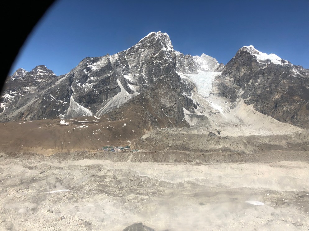
Somewhere around the 50 minute mark, I stepped down a high stone riser and felt a stabbing pain in my right knee. That’s the surgically repaired knee that had been sore since our acclimatization hike at Namche several days before. Suddenly feeling quite unstable, I slowed down, but kept going. What choice did I have? My pilot cum guide disappeared down into the mist. I used my trekking poles like crutches, hopping down the steep path on my good left leg. After another half hour of hobbling, we found ourself at a dead end in some terraces where the trail petered out. My guide started calling out to the small dwellings for someone to guide us onto the right path. Finally we found a local working in his garden who pointed down the hill. Down we went for another 15 minutes, when we finally rounded a corner to see 4 helicopters parked in the mist in front of the “Surke Helipad Lodge”. We had descended 550 m vertically in just 1.6 km (nearly 2000 ft in a mile). Perhaps one of the steepest paths I’ve ever seen.
The swirling fog that shrouded the helicopters made it clear that we had wasted our time, energy, and, in my case, meniscus, on this long plunge down into the gloom. If anything, the fog was thicker here. Then it started raining.
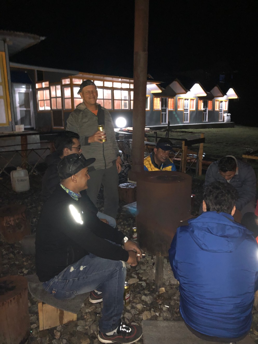
We sheltered in the lodge’s small dining room. Three other American’s were huddled in the room looking exhausted, along with 3 other pilots. The Americans comprised a young Mormon couple (the husband was suffering from Nepal-belly) and a talkative middle-aged guy from I-can’t-remember-where (Texas maybe?). They had evacuated via helicopter from Gorak Shep, the town just below Base Camp. They were headed to Lukla to connect with a fixed-wing flight, but got diverted to Surke just before the fog dropped down. We all waited futilely for a couple of hours, then I threw in the towel and got a room. I asked the lodge’s owner for the penthouse – he gave me the room closest to the toilet ( a squatter that was impossible to use given my throbbing knee). It was not a penthouse, but it was dry.
Following a sponge (baby wipe) bath, I shuffled back to the adjacent ding room and joined the 4 pilots, 3 Americans, and the lodge own and his family. He had a daughter of 25, and was raising his 6-year-old niece whose mother had died just 6 months earlier during childbirth, apparently a common occurrence here where medical assistance can be a day or three walk away. The pilots were already into there 3rd or 4th beer. I thought about buying them all a round, then I thought – “hmm, I would rather not have a drunk or hung-over pilot in the morning”. Didn’t slow them down at all though. After drinking a beer, and while I waited for the chef (owners wife) to prepare meals for all these unexpected guests, I ordered up a Tongba.
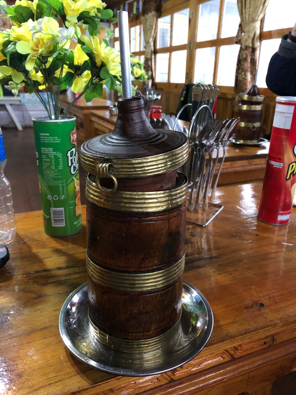
Tongba is the classic alcoholic drink of eastern Nepal. It is made from fermented millet, which is a hardy cereal grain grown in many developing countries because of its high tolerance for adverse weather conditions such as drought. Ok, look it up on wikipedia, I had to. The grain is fermented into a mush by adding various nasty molds, bacteria and yeast, then stored for up to 6 months in sealed jars. When ready, the mash is added to a special wooden vessel, with an integrated straw. Hot water is poured over the mush, and after a few minutes, the alcoholic, warm “tea” can be slurped up with the straw, which has a built in filter to prevent you from slurping up the mash. When empty, you add more hot water to the vessel and you slurp up a second round. In fact I got four rounds out of it (I think, I wasn’t really in any shape to count after the first two). The taste reminded me of hot sake. Not bad, but won’t replace a good IPA.
By the time I finished the fourth round, the weather had cleared, and the stars were out. The pilots and lodge owner (A guide himself who had climbed to the top of Mount Everest twice) had retreated out to the front yard where several stump-chairs surrounded a wood burning stove. The lodge owner soon brought out a case of Everest Beer and announced that it was on the house. Somehow, later that night, I stumbled back to my room and collapsed onto my cot. Supposedly, I was to be up at 6 am for a crack-of-dawn flight down to Kathmandu. Hopefully.
Next up: The final Chapter.