Why I Couldn’t Breathe

The long walk from Namche Bazar to the airport town of Lukla took all day. While mostly downhill, the trail climbed in many places because of the rugged terrain. I had plenty of time along this tiring march to think about the last two weeks, and why I couldn’t complete the trek.

A55A7264-923A-47EE-8C24-69193535E3F3
My lunch stop on the last day.  Lots of ups and downs going along this valley.

About 15 years ago, one afternoon I went out for a run and found myself gasping for breath after only a few minutes. I fought through it, and my breathing improved and I was able to complete the run. For the next couple of weeks, the same thing happened, it was as if my lungs were closing down at first, but then would improve if I went slow and relaxed. I went to my family doctor and he suspected I had some kind of asthma. He prescribed an inhaler to be used twice a day. It worked like a miracle. I told the doc on my follow up that it was like having 25 year old lungs again. A few years later, after a long bout with bronchitis, my doc referred me to to a specialist, who confirmed my asthma diagnosis. I had feared that I had COPD, but the specialist said that the inhaler wouldn’t work on that, and that his testing indicated asthma. Relieved, I still suspect that this stemmed from growing up in a miasma of second hand smoke from my mother. For the next several years, I used the inhaler only before vigorous exercise and it worked very well for a very long time.

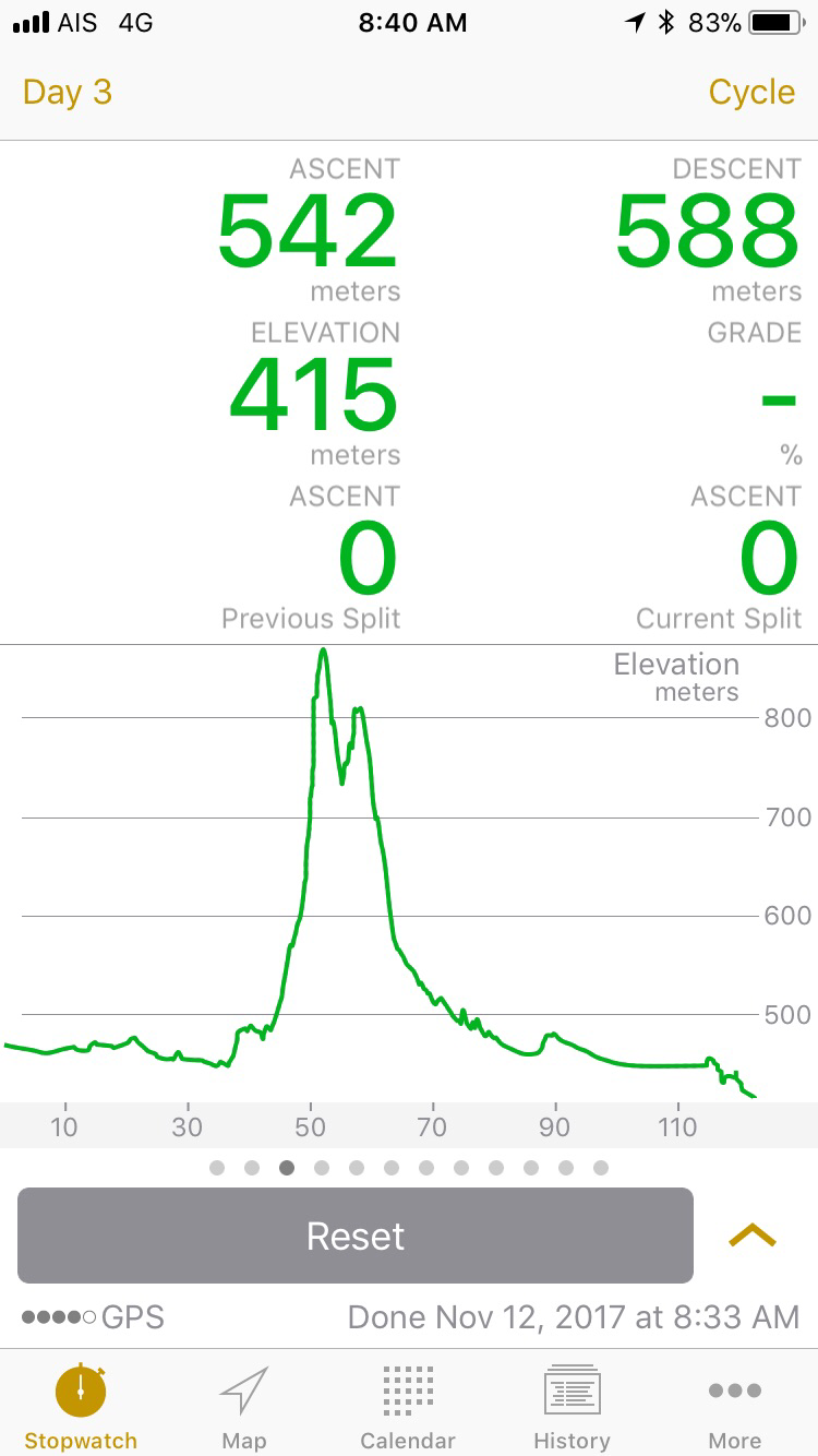
After retirement and my move to Thailand, I found out that I no longer needed the inhaler. Being older, I didn’t exercise so vigorously, and my lungs seemed to like the moist hot air of the tropics. The bag of inhalers I brought from the USA with me got stashed in the back of a drawer and forgotten. A couple of times during my preparations for the trek, I thought to myself that I ought to take an inhaler along “just in case”. But that item never got on my list, and I didn’t remember again until I was in Kathmandu. BIG MISTAKE. My guess is the extremely cold, dry air triggered my asthma. I was ok while hiking if I started slowly, but it seemed to kick in again while trying to sleep. This would explain my lack of headaches or other typical symptoms of altitude sickness. It also explains why my sleeping troubles began at just 2500 m – it wasn’t the altitude alone, it was primarily the cold dry air. If I had brought the inhaler…..anyway, it’s done now. I have no regrets about turning back.

427C433D-0DC5-4BAF-9088-8A6F0E026909
The narrow streets of Lukla.  No motorized vehicles except for planes and helicopters.
64F6E909-A87A-4D52-B6E8-F07C28878270
The picture does not capture the true slope of this runway.

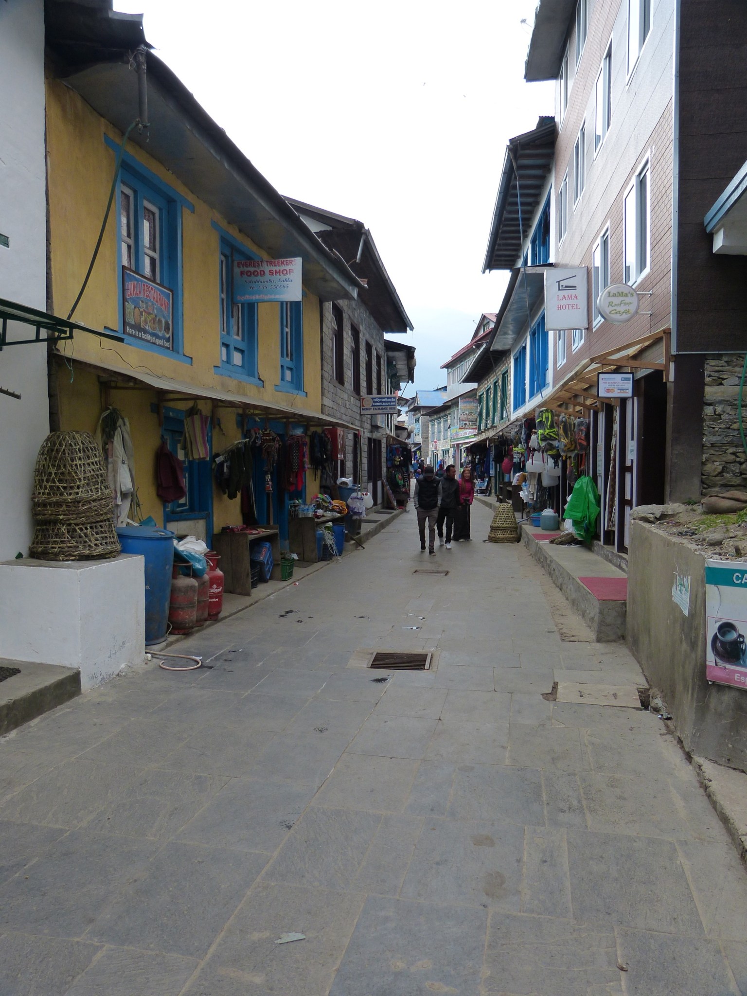
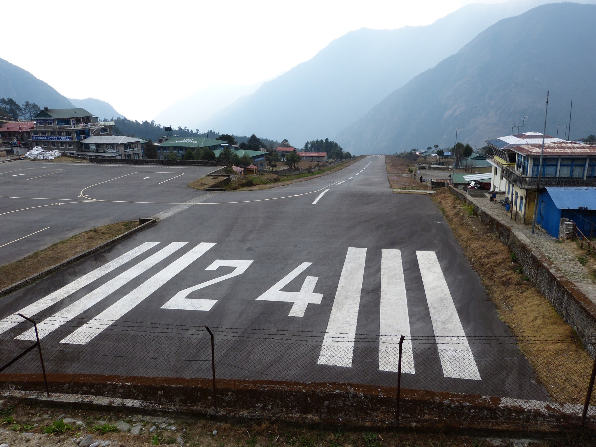
I arrived at Lukla about 4:30 pm after hiking in the light rain for several hours. The lodge was literally 50 meters from the runway. Lukla’s airport is unique in that it is not level. It slopes wildly in fact – more than 11 degrees! It looks more like a ski jump than runway. Planes land uphill and take off downhill no matter the wind. Planes landing have only one chance to get it right because an aborted landing is made impossible by the mountain rising of the end of the runway. Many consider this airport the most dangerous in the world.

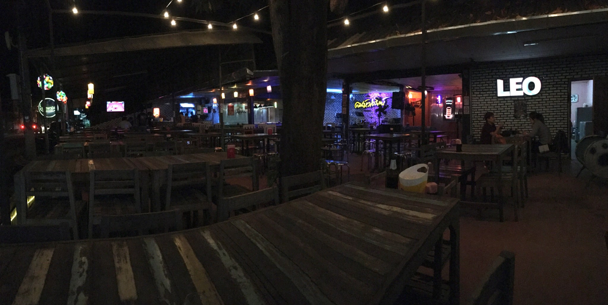
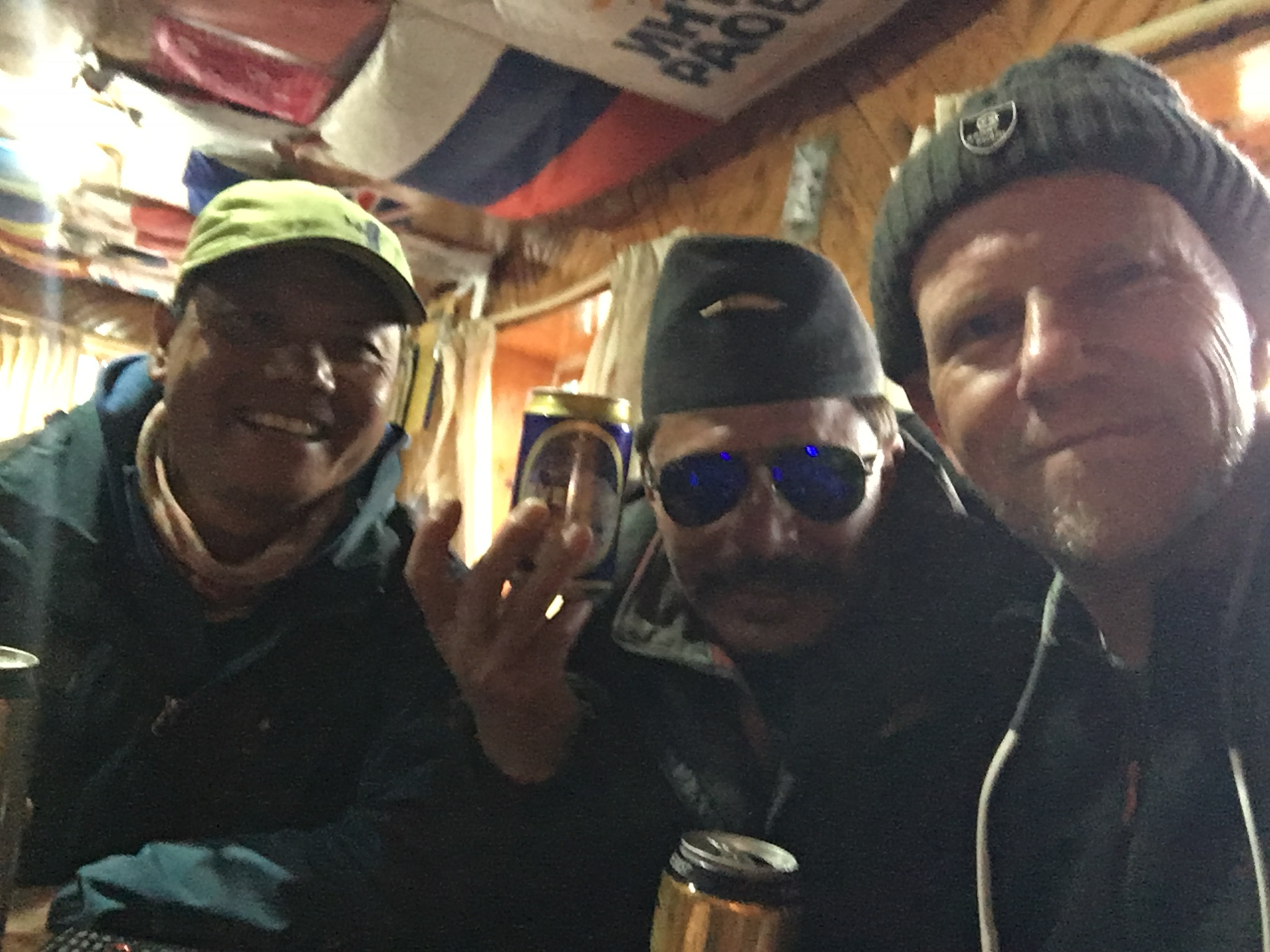
I bought a few beers for my guide  Bhakta and my porter Gokul. Gokul had a few more than a few, and was very loose by the end of the night. Apparently he had a reputation as a brawler in his younger days, he could take on 4-5 others with no problem. Good to have him on my side!

201EFC39-F00F-4C82-B19B-E21352B38F68
Bhakta, Gokul and me celebrating the end of the trek in Lukla.

The next morning, after an E-ticket takeoff, and a scenic flight back to Kathmandu that brought home just how high and immense the Himalayas really are, Bhakta and I arrived safely back in Kathmandu (Gokul turned around and went portering back to EBC from Lukla with a new group of trekkers). Thus ends my adventure. I am back in Kathmandu for one night already, and though the flights are full I will try and get back to Thailand tomorrow. I will be writing another post in the next few days on the equipment I brought that might be useful to future trekkers.

D10506C4-C891-4642-A088-58B5914AFA5A
Walking to our specially designed short take off and landing Sita Air plane for the flight back to Kathmandu.

So what next adventure should I start planning for in 2019? 1. Patagonia? 2. Cruise to the Galapagos? 3. Cycle New Zealand. 4. Golfing in Ireland. 5. Drive the Alaska Highway? 6. Something else?  Leave me a comment with your suggestions.

November 11, 2017 – Bike Tour of Northern Thailand – Up and Over – Fang to Chiang Rai

This distance versus elevation plot shows the story of today’s ride.

The pictured graph – generated by my Cyclometer app on my iPhone, tells the story of today.  A long flat fast approach, a steep, steep, steep climb, then a long run-out downhill, finishing with a fast southward wind-at-my-back race down to Chiang Rai.  Today I only intended to go as far as Mae Chan, a town about 30 km north of Chiang Rai, leaving an easy 30 km for the next day, but I arrived at Mae Chan at 2 pm with plenty of energy. So I just kept going.  November 13 was a planned rest day in Chiang Rai, several friends are driving up here from Chiang Mai to celebrate a friend’s 60th birthday, so I timed my rest day to coincide.  Having arrived a day early, I now have 2 rest days!

This morning, after breakfast at the hotel, I rode northeastward on the main road through green, ripe rice paddies and scattered orchards with the northern mountains looming on the horizon.  I stopped for a cup of coffee and a tasty chocolate cake about 35 km out at the Hom Pan Din Coffee and Bakery.

Fuel for the climb.

Interestingly they also have a small vineyard and they sell locally made wine, raisins and grape jam in their small gift shop. I skipped the wine and headed east.  The climb to the pass was short and brutally steep – but I managed to avoid embarrassment and gutted it out without having to dismount.  At the high pass I was greeted by a tropical deluge.  I sought shelter under the eave of a storage building as a stream of school children, apparently headed home from school for lunch, frolicked in the rain and gawked at the crazy farang1 with the weird shorts.  The rain persisted, although I could see blue sky beckoning toward me from the east.  Finally I pushed on despite the rain, becoming completely soaked within 30 seconds.

A short distance east of the summit, still in the downpour, I passed the turnoff towards the north to Mae Salong. Mae Salong is a very strange village built along the crest of one of the highest ridges in the northern mountains.  The ethnic Chinese that populate this region are the descendants of a remnant of Chiang Kaishek’s anticommunist army.  When General Chiang retreated to Taiwan, a couple of regiments of his army became separated in southern China.  They refused to surrender and continued the fight, eventually retreating to northern Burma.  The Burmese were not welcoming.  Fortunately for these lost soldiers, the ever pragmatic Thais, involved with their own war against the communists, invited these rebels turned mercenaries to fight for Thailand in exchange for Thai citizenship.  In order to finance the war, the new Thai citizens turned to opium and the drug trade – the beginnings of the famous Golden Triangle.   Tea and tourism have since replaced opium in the economy of this now peaceful village.  I would say these soldiers did pretty good for themselves. My original plan called for me to cycle up to Mae Salong, but fortunately I had the opportunity to visit Mae Salong by car a few weeks ago.  My car barely made it up the mountain, trying to cycle up there would have been a disaster!

The deluge gave way to sunshine and badly needed warmth as I raced down the hill toward the east.  For nearly 30 km I barely had to pedal.  This section of road follows the linear Mae Chan Valley – linear because it marks the long east-west-trending Mae Chan fault – an active strike-slip fault, like the San Andreas Fault’s little brother.  Fortunately, no temblors today.

Typical Road-side shrine. Note the offerings of food left for the spirits.

Spirit Houses

Small road-side shrines commonly mark particularly windy and/or mountainous stretches of highway in Thailand. A varying number of spirit houses, mailbox-sized mini-temples sitting on low pedestals commonly accompany these shrines. My understanding is that relatives of car/motorcycle casualties place the spirit houses near to the accident sites so that their ghosts have a place to live close to where they became separated from their hosts.  I am hoping that my spirit does not wind up in one of these anytime soon.

I cruised into Chiang Rai about 4:30 pm, checked-in, and had a short rest before heading out to feed my starving belly.

8318B59A-F1E2-4BC5-BDAA-FBCA716EC7EB
A “San Fran” cheeseburger, the real reason I skipped Mae Chan and continued to Chiang Rai

I will spend the next 2 days in Chiang Rai to celebrate my friend Scot’s birthday and play a round of golf (thanks to Scot for bringing up my clubs!).  I will need the additional rest because the next segment of my tour calls for a 117 km leg up to the Mekong River.

1 The word farang is used by Thais to refer to persons of European descent.

November 10, 2017 – Bike Tour of Northern Thailand – The Road Less Traveled -Phrao to Fang

img_4068
The bigimportantcityoffang.

I’m sitting in a bar/restaurant (mostly bar) writing on my iPhone while sipping a Singha beer and waiting for my dinner to come.  After checking in to the Sleeping Tree Hotel in Fang,  I took an hour-long rest before heading out on a mission.  The mission was find a beer and food.  Harder than I thought.  Turns out this town has many restaurants that have food and no beer, and many bars with with dodgy food or no food at all.  I ended up choosing the latter of course.  I’m now at the “Mahanakornfang” which roughly translates as  “BigimportantcityofFang”.  The place is just beginning to fill up, my guess it’s pretty popular on Friday night.  I’ll be in bed by the time things heat up here.  But back to the start…

This morning I was up by 7:00 and saddled up by 7:30.  No breakfast here.  So I headed north towards the town of Phrao.  Turns out the Phrao Basin is not really flat.  A 1 km hill greeted me almost immediately. Not steep, but it still worked as good as coffee to wake me up and get me in a lather.  I arrived in Phrao about 45 min later.

Pad grapow moo

Phrao is a really small town, which surprised me a little because it is an amphoe – the equivalent to a county seat in the USA.  Basically it’s a one block town.  I made the complete circuit and found an empty restaurant that was just opening.  I fueled up on my go-to dish of Pad Grabow Moo (spicy fried pork with chilies and basil).  If I am ever executed, this would be my request for my last meal.

I rode west – oh my food has come! … Now I’m back in the Sleeping Tree – I better finish this soon because I am knackered good.  Where was I?  I rode west of out of town through the rolling hills covered with fruit orchids.  As I approached the western range front, I had a choice to make – take the main road west through the mountains, or take the road less travelled which goes over the mountains to the north.  I chose the north.

Google street view showed a reasonably paved road winding its way north, but what it didn’t show was all the up and downs, nor how steep the climbs were.  Two 1 km hills went straight up; I had no choice but to dismount and push my bike.  The first of these was so steep I could barely get my bike up it.

Although this route was brutally mountainous, I was amply rewarded with views like this.

I finally emerged from the mountains by about 2 pm and joined the main Chiang Mai to Fang highway.  Unlike Phrao, the Fang Basin is a pancake –  with the additional benefit of a constant stream of traffic whooshing by me and providing a nice draft.  However the ride was far from pleasant.  About 30 km south of Fang, the route turns into a Thai version of one of those endless strips of busy roads that lead into so many towns in the US. I rode through 30 km of roadside markets, car dealers, factories, 18 wheelers, and endless road construction.  However civilization has it perks. I stopped at a huge gas station plaza and bought myself a well deserved Coke Zero.  I also proved the common adage that “hunger makes the best spice” by having a DELICIOUS meal from Five Star Chicken, Thailand’s version of KFC in a push cart.

I arrived finally at my hotel in Fang.  An excellent workout today. This town is a bustling place with lots of dusty traffic.  I’m not sure what is driving their economy, but it seems to be somewhat of a boom town.

You know what happened from here already – so now it’s time for a nice long sleep.  Talk to you from my next stop.